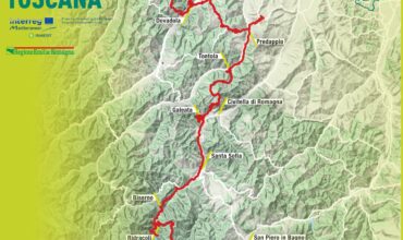
A 120 km route aimed at conquering the dam, hill after hill, peak after peak with the only aspiration to see the great blue expanse. From Castrocaro Terme follow the signs for Dovadola and Rocca San Casciano. At Rocca San Casciano, before the bridge, turn left towards San Zeno and Galeata. After a few hundred meters, face a climb of more than 5 km leading to the top of the Colle delle Centoforche (551 m s.l.m.). Get off to merge into the SS 9 ter.
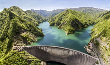
At the crossroads turn left and after 700 m you reach San Zeno. At the junction, turn right towards Galeata. After 2.8 km of ascent you reach the top of Monte delle Forche (444 m s.l.m.). From here, descend to the center of Galeata. Turn right to Santa Sofia. In Santa Sofia, after the bridge, follow the signs for Campigna and Florence. Continue along the state road for a few km, then turn left to Ridracoli (follow the tourist signs). Arrived at the gate that delimits the area of ??the dam (at km 55.2), face 3 km of climb. Once in Galeata, travel the way on the opposite. In Galeata follow the signs for Forlì.
At 100 ° km there is located in Meldola. Go through the village of Meldola and reach the hamlet of Para. Here, turn left to San Martino in Strada (via Monda). Once in San Martino in Strada, at the intersection, turn right for Forlì. After 2 km, at the traffic lights, turn left to Vecchiazzano and Castrocaro Terme.
Route: Castrocaro Terme – Rocca San Casciano – San Zeno – Galeata – Santa Sofia – Isola – Diga di Ridracoli – Santa Sofia – Civitella – Meldola – Para – San Martino in Strada – Castrocaro Terme


